By Yousef Khatib
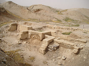
Camillo Sitte believed that there is an art in the planning of cities; so then that would define the “city” an urban landscape, a defining measure of cultural value. Various historical and contemporary critics of urban landscapes, express that architecture and urbanism have always been products of social, cultural, political, economic and environmental conditions; since prehistory, urban and agricultural revolutions transformed humans from being mere figures in the landscape to shapers of the landscape. The historic site of Jericho is a testament to the struggle that “urban” landscapes produce, the stressor being the appropriation of a historical foundation for establishment of an ethnic identities. Jericho has been a site of prehistoric populations that are expressed as culturally valuable foundations between Arab, Christian and Jewish cultures. (Akkermans 2004) The appropriation of these “urban landscapes” has been used to culturally enrich the development of sites throughout the West-Bank by Israeli settlers and Palestinian homesteaders, this action mirrors their individual national aspirations and goals for the future. The language of architecture and urbanism is being used to represent a nation’s identity, values and culture; by branding them in an up-marketed fashion and basing them on blurred historical ties.
At present contemporary “Palestine”, having had a history of colonization, is currently occupied by the state of Israel. The process of defining a national identity is of a major significance in order to achieve what the majority of Ethnic Palestinians around the world and within the physical state aspire; a Palestinian factual independence. (Murphy 1993) The production of Architecture and Urbanism as one agent of defining a national identity, among many other agents, must be responsive and conscious to that issue. However, most scenes of this kind of production in Palestine are metamorphosing into duplications, confined to the Israeli colonial imagery – yet to be seen and/or utilized by Palestinians. Such prevailing, yet recent exercise of image reconstruction, or space reproduction, negatively impacts and hazards the course and process of defining a contemporary national identity for Palestine. This cloning of “Israel” burdens the Palestinian state (people) with adversity in gaining a factually independent state.
The purpose of this essay is to investigate – and question – the current architectural and urban productions in the Palestinian territories. The issue of colonial image reconstruction in times of a political instability, with a focus on the construction of new Palestinian housing projects which will be compared with the architectural image of Israeli settlements, focusing in the metropolitan area of the City of Ramallah.
Introduction
The Palestinian-Israeli conflict can be narrated briefly as follows: First recorded in late 19th century by Theodor Herzl in his book “Der Judenstaat” the ideology of a “Jewish State” was established, it was furthered in the early 20th century by emigration of European Jews avoiding persecution by anti Semitic governments of the period. As an ideology, Zionism emerged as a popular movement among secular Jews to mediate religion and state. (Tesler 1994) With that emergence, a large number of Jewish populations started emigrating from all over the world to Palestine creating many political conflicts with the established populations, mainly over the physical geography on a day-to-day basis. On the 14th of May 1948, Israel was declared as an independent state with undefined borders in a secret declaration ceremony in Independence Hall (Formerly known as the Tel Aviv Museum); due to the secretive actions conflict was incited with the established Palestinian populations. As a result there has been an ongoing territorial expansion into traditionally Palestinian lands. This was prefaced as a failure scenario by Herzl, as he predicted that aggressive expansion of a Zionist State was not the appropriate exercise of sovereignty. The Arab-Israeli War followed, lasting 3 years until a truce could be developed; followed by continual immigration of ethnic Jews from Arab nations and emigration of Palestinian (Secular and Arab) out of Israel controlled land (Aharoni 2002)
Expansion of Israeli control continued mainly by constructing military and civilian settlements in the West Bank and Gaza Strip, which are deemed illegal by the international law and the Fourth 1949 Geneva Convention (Section 1 Article 4). At present, there are many Israeli settlements located on the hilltops of Palestinian lands which hinder the peace process and the possibility of a two-state solution in the region. Their visually strategic dominance of the geography and imposition of an “alien” urban landscape, impedes the Palestinian daily life; specifically with the infrastructure of roads, checkpoints and barriers that are established to “protect” these settlements. Where there is near physical proximity of Israeli and Palestinian people, an antagonizing and imposing construction of a “Separation Wall” between the West Bank and Israel, rips apart the urban and rural landscapes; much alike the Berlin Wall did post WWII . Physical mobility of goods and people, continuity and connectivity of space, urban expansion, use of natural resources and agriculture, among many other practices in Palestine, are being obstructed by its presence. Weizman and Segal, authors of the now censored “A Civilian Occupation: The Politics of Israeli Architecture” by the Association of Israeli Architects; argue that the most dangerous consequence of that presence is the display of power across the landscape that is emphasizing the Israeli dominance on the Palestinian lands and rendering the Palestinians powerless against the Israelis. (Weizman and Segal 2003)
The year 2012 was a pivotal year in the history of the Palestinian-Israeli conflict, on Nov 29th of that year, the United Nations granted Palestine recognition as a Non-Member Observer State on territory in the West Bank and Gaza Strip. Though this acknowledges the “statehood” of the Palestinian archipelago, it is without defined territorial boundaries. There are various proposals and drawn map boundaries; though the political division of the invested Palestinian governing bodies and the existence of Israeli settlements on the Palestinian territories; alongside the extended conflict in the Gaza Strip between the Palestinian National Authority and Hamas (a religion based quasi-governmental organization) which currently governs The Gaza Strip; all act as adversities to political and economic stability of future Palestinian statehood. This ambivalence in stability weakens the consolidation of a national identity, allowing for an infiltration of external cultural references to develop and/or loss of culturally valuable historical urban lifestyle and standards. The primary antagonist in the conversion from the Occupied Palestinian territories to the state of Palestine, can be attributed to the Israeli settlement occupation.
Vale (1992) suggests that architecture and urban design, as products of power relations, play a vital role in the process of forming and enforcing a national identity. However, in Palestine – as a state that is currently being established and in struggle to define its contemporary identity – little or no attention is being given to the spatial and visual culture of architectural production, despite the fact that it has recently been experiencing a boom in the construction sector as international investment has resumed primarily by external arab governmental bodies, which work through generally “western world” based architectural design and planning organizations. The consequence of such inattention is clearly manifesting itself in the City of Ramallah, specifically the new housing projects that are being constructed as replicas of Israeli settlements.
The essay will focus between two different phases of development, from established city of Ramallah to the bourgeoning Rawabi, a new Palestinian city in initial construction phase. There are three sections which will individually express how the recent urban trend of building new residential neighborhoods with, a colonial architectural image and in the form of Israeli settlements, affects the trajectory of the Palestinian collective project towards independence.
Ramallah Metamorphosis.
Assadi (2010); a Palestinian journalist, confirms that Ramallah in the West Bank has lately witnessed rapid and substantial transformations from a small agricultural town to the main administrative and economic center and the de facto capital of Palestine. This growth is not only because it is in the West Bank where 60% of the Palestinian population lives but within the 30% of possible construction zone; (UN – General Report 2011) but also due to the Second Intifida of 2000 (a resurgence of hostile action between the Israelis and the Palestinians) and the movement restrictions that have accompanied it. Ramallah’s geographic location close to the traditional capital of Jerusalem and the lack of settlement expansion into the immediate area meant there was easier movement between local transport avenues; as these resource routes for smaller cities could be blocked/restricted from outside access for extended periods. (Assadi, 2010) Ramallah has hosted the Palestinian National Authority (PNA) headquarters, as well as many local and international organizations and institutions since the Oslo agreements in 1993, changing the political, cultural and social landscape of the city, as well as its architecture.
“There is no question, however, that the establishment of the Palestinian Authority after the Oslo accords in 1993 was another watershed in Ramallah’s Journey from small village to central city for the Palestinians in the occupied territories…The arrival of the PA also had important consequences for the physical appearance of the city, as property laws and zoning regulations were changed to allow for the ownership of individual units in apartments buildings and the construction of multi-storey buildings. The skyline of Ramallah changed dramatically in the decade following the Oslo accords.” (Taraki, 2008)
Vis-à-vis with these transformations, Ramallah has also witnessed many migration waves from other cities and villages in the West Bank – where jobs are fewer. Naturally and in response, there has been a great demand on the housing sector accompanying these migrations. Due to many factors such as the crowdedness of the city, the increase in land and property prices, and the alteration of land-use and zoning regulations, Ramallah has expanded rapidly and vastly to accommodate such transformations. The trajectory of that expansion has been outside the center and mainly towards the northern parts as the most possible way of expansion due to political and environmental factors. It has been proposed by Taraki, Palestinian journalist, educator and sociologist, that zoning regulatory changes, land scarcity, stringent private individual loan market and lack of commercial development have facilitated a disparity in the quality of life for Ramallah’s residents. Ranging from well maintained communities with premium market value, to less valued yet stable settlements in the periphery of the city. (Taraki, 2008)
Taraki does not mention the resemblances between these new settlements and the Israeli settlements, yet Taraki refers to them as settlements, a very critical and powerful term, especially in a discourse that addresses the Palestinian case. The term settlement, English for mustawtanah (Arabic) implies firmness, stability, domination and evokes negative and antagonistic feelings for any Palestinian. The presence of Israeli settlements evokes such feelings as well. However, the form, or the image of these settlements has become a model to follow, a spectacle and a desirable paradigm that the new Palestinian housing projects, which are recently being constructed on the northern outskirts of Ramallah resemble.
The new Palestinian Settlements, a mirror of the existent Israeli Settlements.
In their book, A Civilian Occupation; the politics of Israeli architecture, Eyal Weizman and Rafi Segal (2003) present different episodes of the Israeli architecture as a political tool of colonizing the Palestinian territories while focusing on the continuous construction of the Israeli settlements in the West Bank. One of these episodes is an article by Gideon Levy; an Israeli human rights activist and columnist covering Palestinian human rights, entitled as ‘The Lowest Points in Israel’, in which he portrays the Palestinian view of these settlements. Levy states:“The lowest points in Israel are to be found, of all places, on the mountain peaks and hilltops. It is no mere chance that the settlements built by Israel in the territories it has occupied have positioned themselves on these lofty heights. The settlements are almost always up there, scarring the landscape, dominating the plateau, challenging, provoking, picking a fight. Down in the flatlands live the ‘natives’ – the Palestinians… The settlers up above, the Palestinians down below – this is the essence of the story… One beside the other, two communities living in hatred and fear of each other. One on top, armed with tanks, roadblocks and helicopters, the other below, armed only with their steadfast hold on the land. Which is stronger? And which will survive?” (Levy, 2003) This spatially embodied mechanism of displacement – ‘the up above and down below’ has without question rendered the dispersed Israeli settlements fearsome and gruesome by the Palestinians. The Israeli settlements have become Heterotopias, as Foucault would call them, real places yet spaces of the other, whose architecture display trepidation and cause agony for the Palestinians.
After his return to Ramallah, his hometown from exile, the Palestinian poet, Mourid Barghouti wrote: “The first morning in Ramallah. I wake up and hasten to open the window. ‘What are these elegant houses, Abu Hazim?’ I asked pointing at Jabal al-Tawil, which overlooks Ramallah and Bireh. ‘A settlement’…” (Barghouti, 2005) Three years ago, I asked the same question pointing at the Diplomat housing project, which overlooks Tireh in Ramallah. ‘Not a settlement – yet looks like one’. This project and the many new Palestinian housing projects in Ramallah City sprawl over the hilly landscape and olive-treed terraces while penetrating the northern villages of Ramallah and al-Bireh Governorate.
The projects are masqueraded with an Israeli-colonial architectural camouflage, as replicas of Israeli settlements and with the colossal billboards spread throughout the West Bank. These Palestinian projects guarantee their residents with safe, deluxe and superior life. This strategic use of a readymade architectural image – which representative to the Palestinian community as an image of them; the other or the enemy – as a capital to sell us their architecture, is a very critical tool of power exerted, and imposed, by both property investment tycoons and decision makers in Palestine. Critical in terms of creating new visual and spatial language, or trend, that jeopardizes the present and the future of the collective Palestinian sovereignty.
Once architecture of anguish, oppression and misery, this exact architecture has become a dream, a desire, a lust, an ideal form, an Utopia. The architecture of the Israeli settlements has been rendered as an ideal erotic epitome that the new housing projects in Ramallah follow. Consequently, one may ask how this architecture transformed from being terrifying to satisfying? Is it the fiction of safety that this architecture conveys what makes it desirable? Would the act of copying the architecture of the Israeli settlements create a sense of familiarisation to their existence among the Palestinians? Or is it already a manifestation of accepting that existence on the Palestinian territories? What are the impacts of such act, especially in times of establishing a Palestinian statehood?
Live, Work, Grow in Rawabi
Rawabi; Arabic for hills, Reehan; Arabic for basil, Ghadeer; Arabic for brook, Itihad; Arabic for union, Jinan; Arabic for paradise, are the names of such projects. With slogans like ‘Live, Work, Grow’ and ‘A place where needs are fulfilled’, one can easily associate these names with clichéd terms or replicas for Utopia.
Rawabi is slated to be composed of approximately 4,000 “low-income” accessible homes, situated on the periphery of the current Ramallah metropolitan region. The estimated capital invested is approximately 200 Million USD (125 Million GBP), backed by Gulf based Qatari Diar Real Estate Investment Company. The Palestinian National Authority has shown enthusiasm about the plans for the new city, and views it as a truly valuable and needed project for the Palestinian people. With a population capacity of 25,000 people it serves the growing palestinian population an opportunity to access home ownership, employment, education, leisure without having to be burdened by the Israeli checkpoints. Though it provides benefits that are highly in need, it’s up-marketing and promotional media circulate phrases such as“… an attractive environment in which to live, work and visit.” Such propagandist language is even better expressed by the clearly depreciative language in its publications “Rawabi is a true quality of life option well within the financial reach of many young Palestinian families” (Rawabi.ps 2011); this language sells a false notion of reality in Palestine by invalidating the quality of urban life prior to the Israeli occupation.
The expressive qualities of Rawabi’s architecture render it as a typical facsimile of an Israeli settlement. Intentionally or unintentionally, Rawabi’s form and image, its position on the hilly landscape and its relation with that landscape, its mathematical functionality, its brutality and frigidity represent the new Palestinian town as an alien settlement between the neighboring Palestinian villages. However, the Palestinian community and authority are becoming obsessed with Rawabi. Rawabi has become a syndrome for the Palestinian young families. Everyone wants to live, work and grow in Rawabi. “All of these projects, none has the symbolic value of Rawabi, now billed as the gateway to the future Palestine.” (Hollen 2012) Another question emerges here as well: Is a future modeled by such projects what the Palestinians want for their new state?
Propose that the project Rawabi an act of image reconstruction, that is surmountable to a masked occupation, This same act renders the architectural image of the occupation- as manifested in its settlements- familiar and normal, while representing the occupation itself as ordinary, unthreatening and accepted. Accepting the image and the architecture of the occupation, and copying them, would eventually result in accepting the occupation on the Palestinian territories, blocking the trajectory of the collective Palestinian ambition of a sovereign state with a distinguished contemporary identity.
On the other hand, Rawabi and the other new housing projects would also negatively affect the existing urban fabric in the region, especially the neighboring villages. Such projects would increase the gap between the different Palestinian groups, foster social segregation among the society, as well as create uneven economic distribution within the city. Additionally, and within the acute condition of land scarcity in the West Bank, such sprawling projects are consuming the remaining land in an irrational manner and affecting the development process of the whole region. In this context and the above, the question of responsibility and liability must be addressed to the investors, the decision makers and the designers of these projects.
Conclusion
Weizman and Segal have argued that conflicts are usually accompanied with rapid urban change and transformations. The conflict between Palestinians and Israelis is reducible to a conflict over the geography, which is considered sacred and legitimate by both national identities, resulting radical transformations of the landscapes in the area, mainly by using architectural and urban design strategies as cultural and political tools to display dominance and power over the land. Two of the most critical issues in the region are Israel’s continued settlements expansion and land confiscation in the West Bank, and the trend of building new Palestinian housing projects in the image of these settlements. This mechanism of image reconstruction, or space reproduction, has the ability to induce a sense of familiarization to the existence of Israeli settlements on the Palestinian territory, it will also create a new culture of accepting and indifference to the illegal presence amongst Palestinians, affecting the myriad resistance projects, but most costly to the collective goal of a sovereign state.
Since urban expansion is inevitable in the rapidly developing cities of the Palestinian state, specifically speaking of Ramallah metro region, the current architectural and urban strategies should be reviewed, questioned and rethought. Approaches of architecture and urbanism are needed when in the discourse of establishing a state, such dialogue should be more conscious and correspondent to the geography, the history, the identity and the social mechanism of Palestinian life. A process of adjusting and reclaiming the existing Palestinian rural areas and villages to become parts of the expanding cities can be a more sensitive response than building these new Palestinian settlements. Though due to the instability of control over free movement of populations within the region will continue to foster the fore-mention fashion of developments.
Design as a language and architecture as experience; impresses unto the population’s that live amongst them, shared values and culture. The design of the urban landscape at present is creating a false reality in Palestine, as infiltrated Western-Judeo aesthetic is used as a basis; then sold as an up-market alternative to endogenous design values. This should act as an alarm to the Palestinian National Authority, as it should in the best interest of sovereignty, to proactively engage the Palestinian society in the process of shaping the urban landscape. This support of genuine Palestinian identity will aid the recognition of an independent nation, based on culturally valuable assets. Architecture, planning and urban design practitioners in Palestine should be more reflective to this local heritage as a basis; as well as external designers should be sensitive to the historical urban lifestyle and standards of the region.
Bibliography
Aharoni, Ada. 2002 “The Forced Migration of Jews from Arab Countries,” Historical Society of Jews of Egypt website. Accessed 7 January 2013.
Akkermans, Peter M. M.; Glenn M. Schwartz 2004 The Archaeology of Syria: From Complex Hunter-Gatherers to Early Urban Societies (c.16,000-300 BC). Cambridge University Press.
Assadi, Mohammed. 2010. “Ramallah building boom symbolizes West Bank growth.” Reuters. Available from: . [12 Dec 2012]
Barghouti, Mourid. 2005. I saw Ramallah. Ahdaf Soueif (trans.) London: Bloomsbury Publishing.
Foucault, Michel. 1993. “Of other Spaces: Utopias and Heterotopias” in Architecture – Culture 1943-1968 A Document Anthology, J. Ockman (ed.), New York: Rizzoli.
Hamilton, Douglas. 2008. “A biblical view of peace high in the Holy Land.” Reuters. Available from: . [14 Dec 2012]
Hollen, Anna. 2012. “A Palestinian City for a New Generation” Pulitzer Center. Available from: . [5 Dec 2012]
Murphy, Kim. 1993 “Israel and PLO, in Historic Bid for Peace, Agree to Mutual Recognition,” Los Angeles Times, September 10th
Segal, Rafi & Weizman, Eyal. 2003. A Civilian Occupation, the politics of Israeli architecture. Tel Aviv, London: Babel and Verso.
Taraki, Lisa. 2008. “Enclave Micropolis: The Paradoxical Case of Ramallah/Al Bireh.” Journal of Palestine Studies, (vol. 37, no.4): 6-20.
Tesler, Mark. 1994 Jewish History and the Emergence of Modern Political Zionism. Bloomington, IN: Indiana University Printing Press
United Nations (Conciliation Commission for Palestine in Lausanne) 1949 Report of the Technical Committee on Refugees (7 September A/1367/Rev.1)]
United Nations (Office for Coordination of Humanitarian Affairs occupied Palestinian Territory). “General Report” (December 2011) Accessed 7 January 2013
United Nations (Office for Coordination of Humanitarian Affairs occupied Palestinian Territory). “Restricting space in the OPT Area C Map” (December 2011) Accessed 7 January 2013
United Nations (Office for Coordination of Humanitarian Affairs occupied Palestinian Territory). “West Bank: Israeli Demolitions of Palestinian Property” (January 2010- December 2011) Accessed 7 January 2013
Vale, Lawrence. 1992. Architecture, Power, and National Identity. New Haven: Yale University Press.
Yousef Khatib is a Design Architect, author and former faculty member at the Department of Architecture at Birzeit University in Palestine.
He can be reached at yalkhatib@Birzeit.edu
Website: http://yousef-khatib.tumblr.com
Instagram: http://instagram.com/yousefkhatib


- Israelisnipers shooting and killing hospital workers in Gaza - December 11, 2023
- CAIR Condemns Israeli Executions of Wounded, Unarmed Palestinian in West Bank - December 11, 2023
- Arab and Muslim American voters face a “simple choice” between Biden’s inhumanity and Trump’s edgy politics - December 9, 2023

